
Smog in Shanghai, China

News

2015-2019 Average NO2 for the Northeast US 2020 NO2 Map for the Northeast US

Pandemic Before and After: Northeast US 2015-2019 versus 2020

The slider shows satellite data of NO2 from the Aura Ozone Monitoring Instrument (OMI) over the Northeast United States in March. The image on the left shows the mean of the period from 2015 through 2019, while the image on the right shows the mean for 2020. Though variations in weather from year to year cause variations in the monthly means for individual years, March 2020 shows the lowest values a compared to any of the monthly values for March during the OMI data record.

Coronavirus lockdown leading to drop in pollution across Europe

New data, based on observations from the Copernicus Sentinel-5P satellite, are showing strong reductions in nitrogen dioxide concentrations over several major cities across Europe – including Paris, Madrid and Rome.

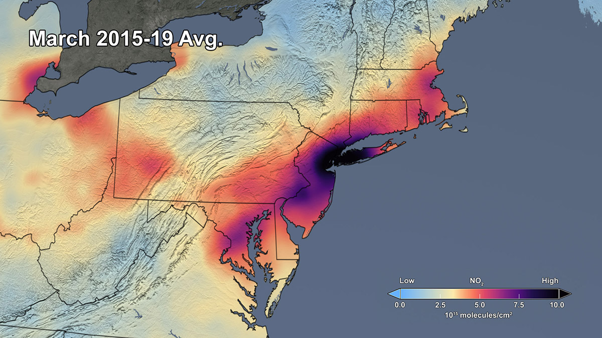
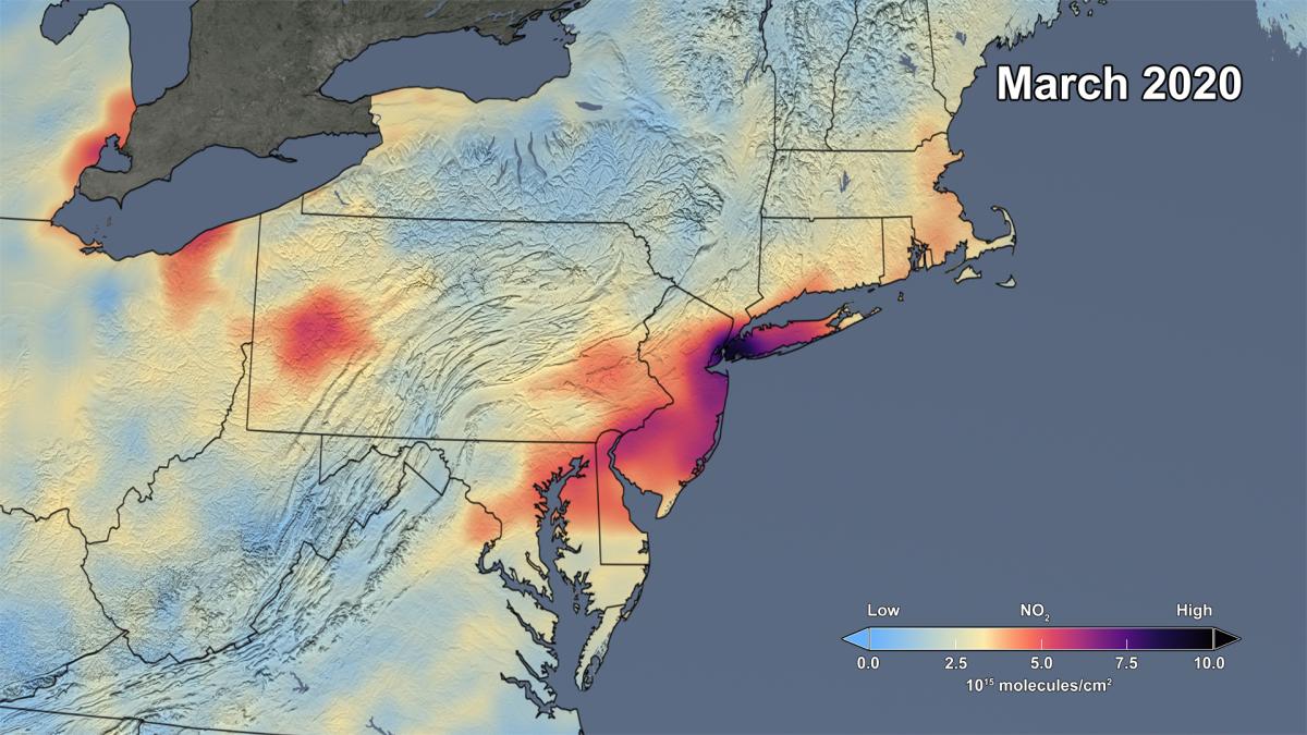
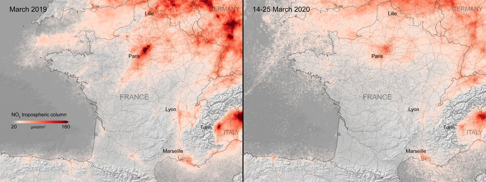
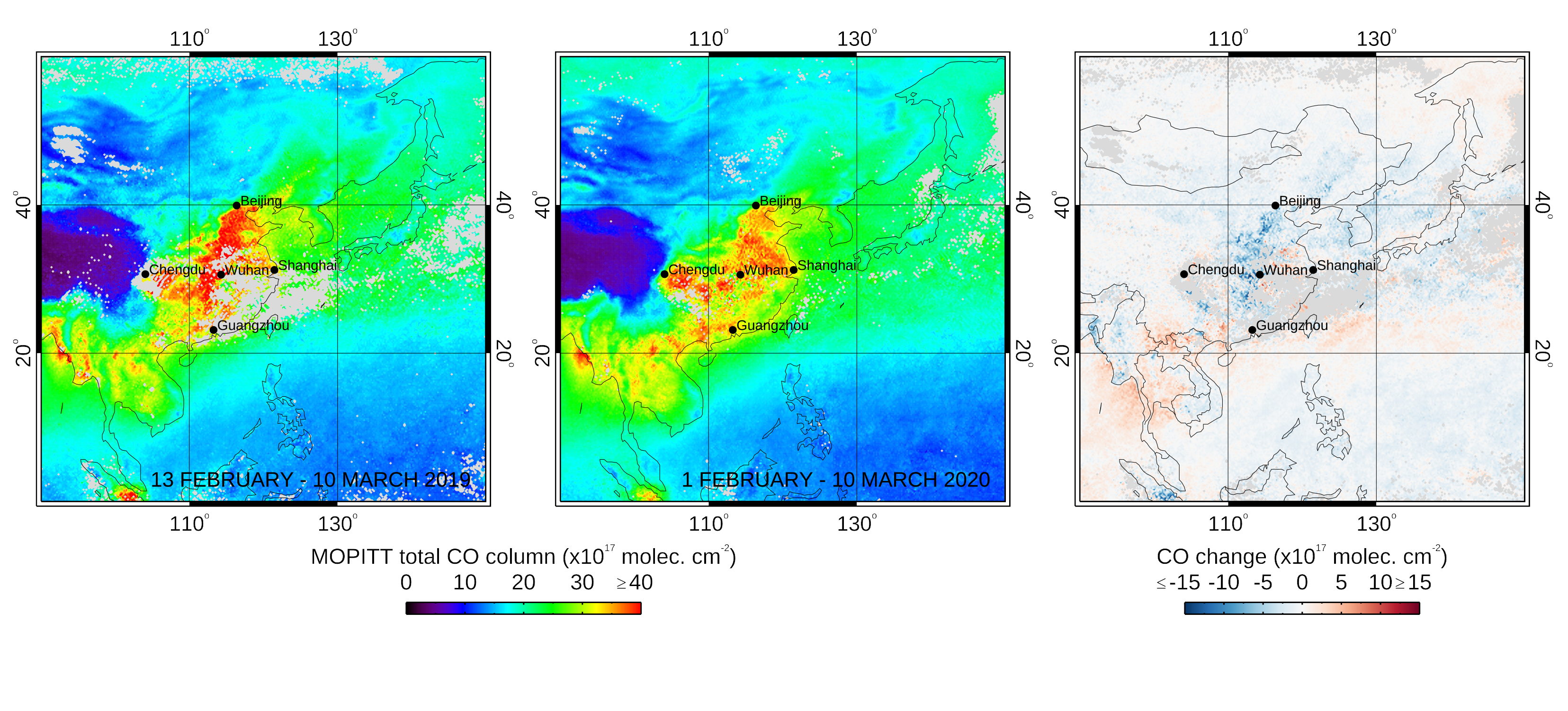
COVID-19 Impact on Asian Emissions: Insight from Space Observations

On March 17th, the lead PIs of ACCLIP (Asian summer monsoon Chemical and Climate Impact Project) made the decision to postpone the ACCLIP airborne field campaign from summer 2020 to 2021. The airborne field campaign was jointly funded by the NSF and NASA, and involves both the NCAR research aircraft Gulfstream V and the NASA research aircraft WB-57. This decision was forced by the global COVID-19 outbreaks.

Airborne Nitrogen Dioxide Decreases Over Italy

In February, we showed a drop in nitrogen dioxide (NO2) levels over China as a result of the coronavirus quarantine. New data from the European Space Agency (ESA) now show drops in NO2 concentrations over Italy due to that country’s nationwide lockdown. The change is particularly evident in the Pro Valley of northern Italy.